What is it?
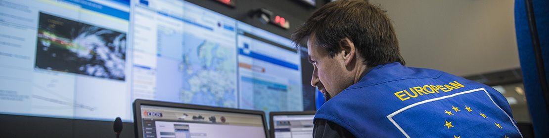
The EU’s early warning and information systems help the Emergency Response Coordination Centre (ERCC) monitor the global situation. These include hazards such as earthquakes, tsunamis, wildfires and tropical cyclones.
In a crisis, having detailed scientific information increases the safety and protection of EU citizens. The EU’s monitoring tools also add to the information available to Member States, helping their emergency services respond more efficiently when disaster strikes.
Why is this important?
Disasters can occur anytime, anywhere. They could be natural, like floods, or human-induced, like industrial accidents. But proper planning, monitoring and early warning can reduce potential damage and even prevent their effects from becoming large-scale emergencies.
With the EU’s early warning and information systems, Member States have more efficient and resilient emergency response systems in place.
Early warning and information systems are an important cornerstone of the EU’s strategy to protect people worldwide. They minimise the impact of a disaster by linking the pre-disaster and response phases.
When disasters occur or are imminent, alerting the population and emergency services is a priority. This warning needs to be as fast as possible to save lives, protect jobs and preserve the environment. That’s why continuous hazard monitoring and early warning systems are used to better anticipate risks, prepare the necessary resources, and warn people in danger.
How are we helping?
The EU supports the early warning and information systems of Member States in their assessment of hazards by contributing to early analysis and action in real-time.
Disaster alerts allow the ERCC to provide a comprehensive early assessment of the event. They also enable early action within the framework of EU civil protection both within the EU and worldwide.
Close cooperation with various research institutes furthers the development of disaster forecasting and disaster management tools for both natural and human-induced hazards:
- The Global Disaster Alert and Coordination System provides alerts and estimates impacts of earthquakes, tsunamis, tropical cyclones, floods, volcanos, and droughts worldwide.
- The European Flood Awareness System and Global Flood Awareness System develops an overview of ongoing and possible future flooding up to 10 days into the future to support preparatory measures for flood events, particularly in large transnational river basins.
- The European Forest Fire Information System and Global Wildfire Information System forecasts dangerous weather conditions up to 10 days ahead and provides near-real-time information on active fires and burnt areas. These systems analyse the severity and risk that each forest fire poses for the local population and the environment. This allows informed decisions on the deployment of the rescEU firefighting capacity.
- The European and Global Drought Observatories give information on potential and ongoing droughts, including meteorological indicators, soil moisture anomalies, vegetation stress and river low flows.
These early warning and information systems are part of the EU’s Copernicus programme.
Tracking disasters from space
Thanks to satellite maps produced with the Copernicus emergency management service, the ERCC can monitor disasters and potential disaster risks from space. It can also assess the impact of disasters and provide maps to support recovery efforts.
The Copernicus satellite maps are essential to the deployment of the EU Civil Protection Mechanism.
In addition, a system of 24 Galileo satellites and ground stations provide geographic positioning information to Member States to broadcast alert messages.
The European Commission has also established the European Natural Hazard Scientific Partnership. This consortium of over 20 partners offers 24/7 monitoring and scientific advice on a wide range of natural hazards both at European and global levels.
The European Anthropogenic Hazard Scientific Partnership brings radiological and nuclear expertise and knowledge to the ERCC.
In case of radiological or nuclear emergency, this consortium of 5 partners will provide a rapid assessment of the situation as well as continuous updates on the ongoing event to facilitate decision-making.
The EU also works with other organisations such as UNESCO’s Intergovernmental Oceanographic Commission.
Supporting public warning systems across the EU
EU early warning tools complement national public warning systems, working closely together with Member States to protect citizens from disasters. It helps to establish and develop national public warning systems.
Last updated: 24/04/2023
Facts & figures
Early warning systems save lives, protect livelihoods, and preserve the environment.
The EU operates specialised early warning systems which monitor hazards both in the EU and globally and supports national authorities by complementing national early warning systems.
The EU Civil Protection Mechanism has enhanced its capacity to assess and evaluate risks as well as disaster impact by engaging scientific organisations and the latest equipment, considerably boosting its preparedness levels.