When wildfires in Portugal were at risk of burning out of control, authorities asked for help from the EU Civil Protection Mechanism. Thanks to monitoring and advance warning from the European Forest Fire Information System (EFFIS), firefighting planes from Greece were pre-positioned in Portugal and flew into action immediately.
Climate change has led to more frequent and more intense heatwaves, which increases the risk and seriousness of wildfires.
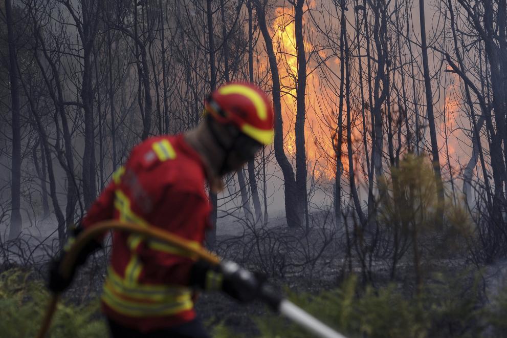
In 2022, fires swept through the Serra da Estrela Natural Park in Portugal, burning around 25,000 hectares of forest and impacting local wildlife, including wolves, golden eagles and peregrine falcons.
Even before the fires broke out, EU forecasting maps indicated a very high risk.
To help Portugal prepare, the EU’s Emergency Response Coordination Centre (ERCC) sent 2 firefighting planes from Greece to the high-risk areas. The early warning meant that once the fire broke out, firefighting pilots could start working to extinguish the flames immediately.
Using data for a rapid response
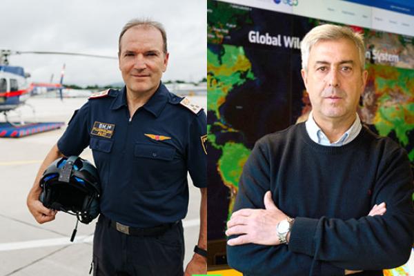
“In Portugal, we are seeing very intense fires. They're happening outside the traditional fire season and they're happening in areas where they didn't happen before,” says Jesús San-Miguel-Ayanz, leader of the European Forest Fire Information System (EFFIS) and Global Wildfire Information System (GWIS) teams at the EU’s science service in Ispra, Italy.
Based on factors such as lack of rainfall, dryness of vegetation, temperature and wind speed, experts like San-Miguel-Ayanz analyse fire danger.
With this information, both EU and national authorities can decide how to allocate firefighting resources so they are ready to act.
In August 2022, after EFFIS identified that the fire risk in Portugal was very high, the ERCC pre-positioned two Greek Canadair aircraft – amphibious ‘water bomber’ airplanes which can disperse water over the affected area to rapidly extinguish the burning – in Portugal.
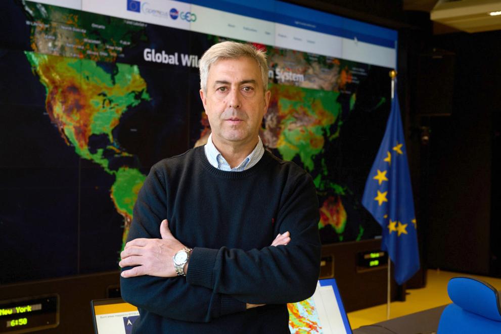
We can identify the areas in which, if there is a fire, the fire will grow and become very difficult to extinguish,” says Jesús San-Miguel-Ayanz. “That allows firefighting teams to be better prepared.
Taking to the skies to help fellow Europeans
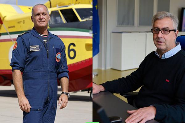
Thanks to this pre-positioning, Stefanos Karpetis – a Greek pilot with over 2,000 hours of experience flying Canadair planes – and his team could leap into action when needed.
After take-off, pilots scoop water into the tanks of the airplane from a lake, river or sea. They then coordinate with the ground crew to find the safest and most effective spot to drop the water.
Throughout the firefighting process, staff at the EU’s ERCC in Brussels played a key role. The Centre coordinates the delivery of assistance from the 27 EU countries and 8 participating states in the EU Civil Protection Mechanism. In this case, they ensured smooth collaboration between Portuguese authorities, Greek pilots and workers across Europe.
“Preparedness and good response in aerial firefighting require a sufficient number of available planes, helicopters, and experienced pilots. When national response capacities are overwhelmed, the country can activate the EU Civil Protection Mechanism to ask for a coordinated, rapid and effective international response,” explains Karpetis.
Despite their severity, the fires were finally brought under control.
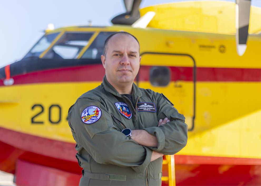
When a forest fire breaks out, the aerial firefighting must start as soon as possible. The actions needed must be well planned, decisive, and fast. We have 20 minutes to head for the planes, start the engines and take off.
“The Portuguese colleagues were excellent,” Karpetis says. “I really appreciated each one of them, and I want to thank them for the help they provided to our team. When the fire is finally extinguished and you realise that you have contributed towards this result, this is really rewarding.”


After a record-breaking fire season in 2022, the EU is proposing to increase the budget for rescEU – the EU-financed firefighting fleet – by €170 million and to double its capacity before the 2023 wildfire season.
The upgraded fleet will have up to 12 additional light aircraft, 3 new helicopters, and more pre-positioned ground teams.
The latest satellite mapping and analysis will guide those teams. Throughout his career, San-Miguel-Ayanz has seen huge improvements in the resolution and speed of the satellite mapping he uses. Improvements like this will help countries to prepare and respond to fires in the future.
“I will continue improving the information we have and the accuracy of our fire behaviour models. We must determine where the fires will impact next,” says San-Miguel-Ayanz.
Discover more stories
When fires broke out in Slovenia in July 2022, the EU’s Civil Protection Mechanism sprang into action. EU satellite mapping determined the progression and direction of the fires and Austrian helicopter pilot Josef Samonig used this to decide where to focus his firefighting efforts.
When wildfires broke out in Germany’s Harz National Park in September 2022, German authorities called on the EU’s Civil Protection Mechanism to help save the forest. Aided by EU’s satellite data, Italian pilot Martino Franchini flew in to help fight the blaze.
When floods in Pakistan washed away roads and made travel treacherous, authorities asked for help from the EU Civil Protection Mechanism. Guided by the EU’s satellite maps, Finnish logistics expert Juuso Nummela helped ensure life-saving aid arrived where it was needed most.